
UWA Conducts Aerial Wildlife Survey in Bokora–Matheniko Wildlife Reserve
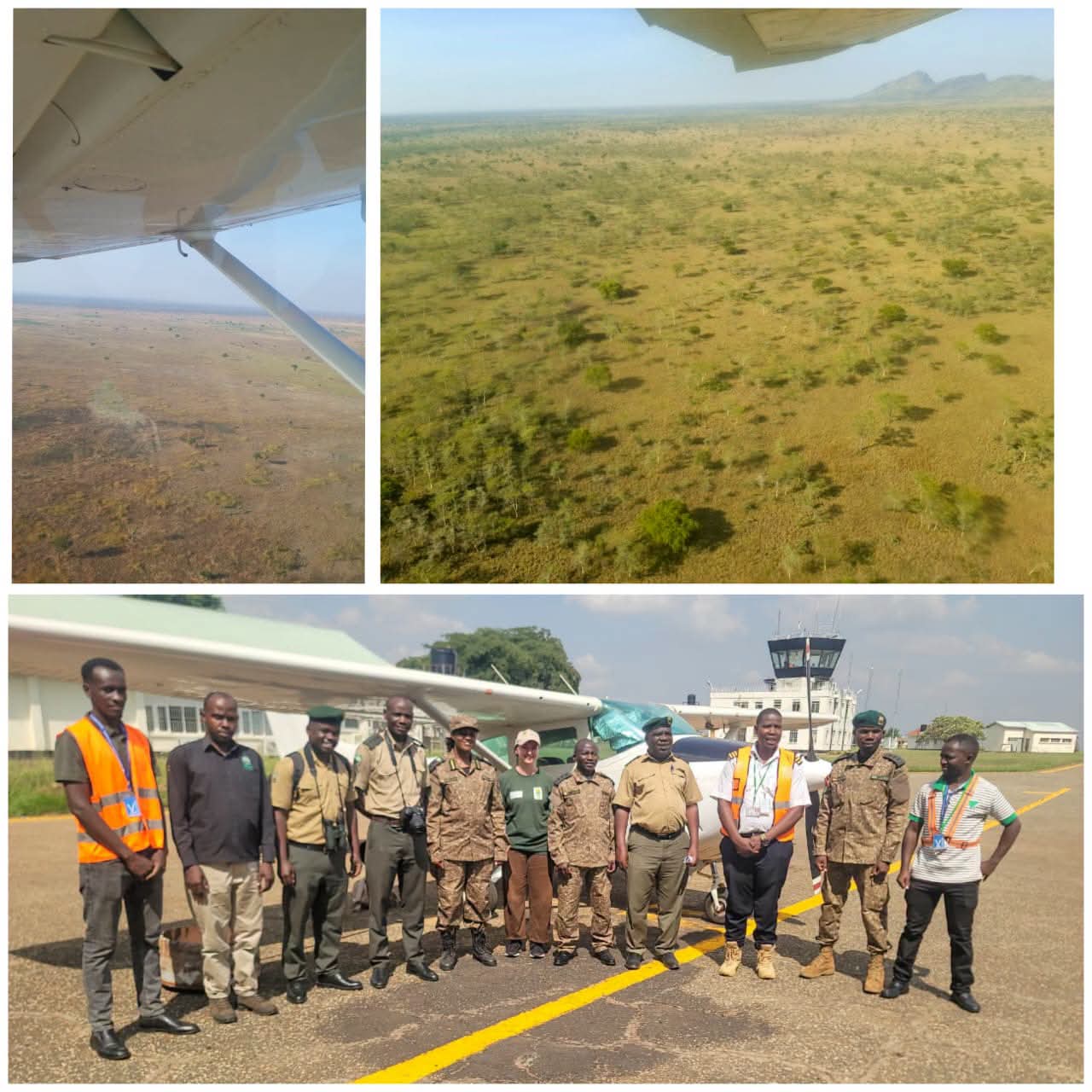
UWA has commenced a 10-day aerial wildlife survey in Bokora–Matheniko Wildlife Reserve, within Pian Upe Conservation Area, to assess wildlife populations and emerging conservation challenges across the protected area.
UWA’s Division of Research and Ecological Monitoring, in collaboration with the Air Wing Division, is conducting the survey, combining scientific expertise with aerial operations to collect vital ecological data.
The exercise builds on the last aerial survey conducted in 2018 and will provide an updated picture of the reserve’s wildlife populations and habitat conditions.
A key objective of the survey is to estimate wildlife populations, assess the extent of illegal activities, particularly unauthorized livestock grazing, and identify emerging threats that could affect the reserve’s ecological integrity.
The findings will provide critical data to guide evidence-based management decisions, strengthen conservation interventions, and support the long-term protection of wildlife and their habitats.
Through regular ecological monitoring, UWA continues to make informed conservation decisions that ensure Uganda’s wildlife resources are sustainably managed for present and future generations.
History of Bokora-Matheniko Wildlife Reserve
Bokora-Matheniko Wildlife Reserves, often referred to together as MBWRs, are two adjoining protected areas in northeastern Uganda’s Karamoja sub-region. They were created to protect the semi-arid savanna and to secure wildlife migration routes used by Karamojong pastoralist communities for centuries.
Both reserves were gazetted in 1964. Before that, they were part of the larger Central and South Karamoja Controlled Hunting Areas. Bokora was specifically established as a corridor to ensure “freedom of movement for the game during migration between the Matheniko plains and Pian-Upe Game Reserve”. Matheniko had similarly served as wet-season pasture for herds migrating from southern Karamoja, especially from the Pian-Upe plains.
Location and size
Bokora Corridor covers 205,600 ha / 794 sq km, lying between Moroto and Mount Elgon, and between Matheniko and Pian-Upe. Matheniko covers about 158,650-160,000 ha, just north of Moroto along the Uganda-Kenya border. Together with Pian-Upe they form about 3,500 sq km managed under the Mt. Elgon conservation area.
These reserves are named after the Bokora and Matheniko clans of the Karamojong people, who still live adjacent.
Game Drives and Wildlife Viewing
Game drives in Bokora-Matheniko Wildlife Reserve are the main way to explore its rugged Karamoja savanna. Early morning and late afternoon drives give the best chances to see eland, Bright’s gazelle, oribi, ostrich, buffalo, hyena, leopard and cheetah.
Because of rough, rocky tracks and dry riverbeds, 4×4 safari vehicles are required. Most tours use open-roof Land Cruisers or rugged safari vans with high clearance, often with a UWA ranger and local guide. The terrain is remote, so self-driving is discouraged.